
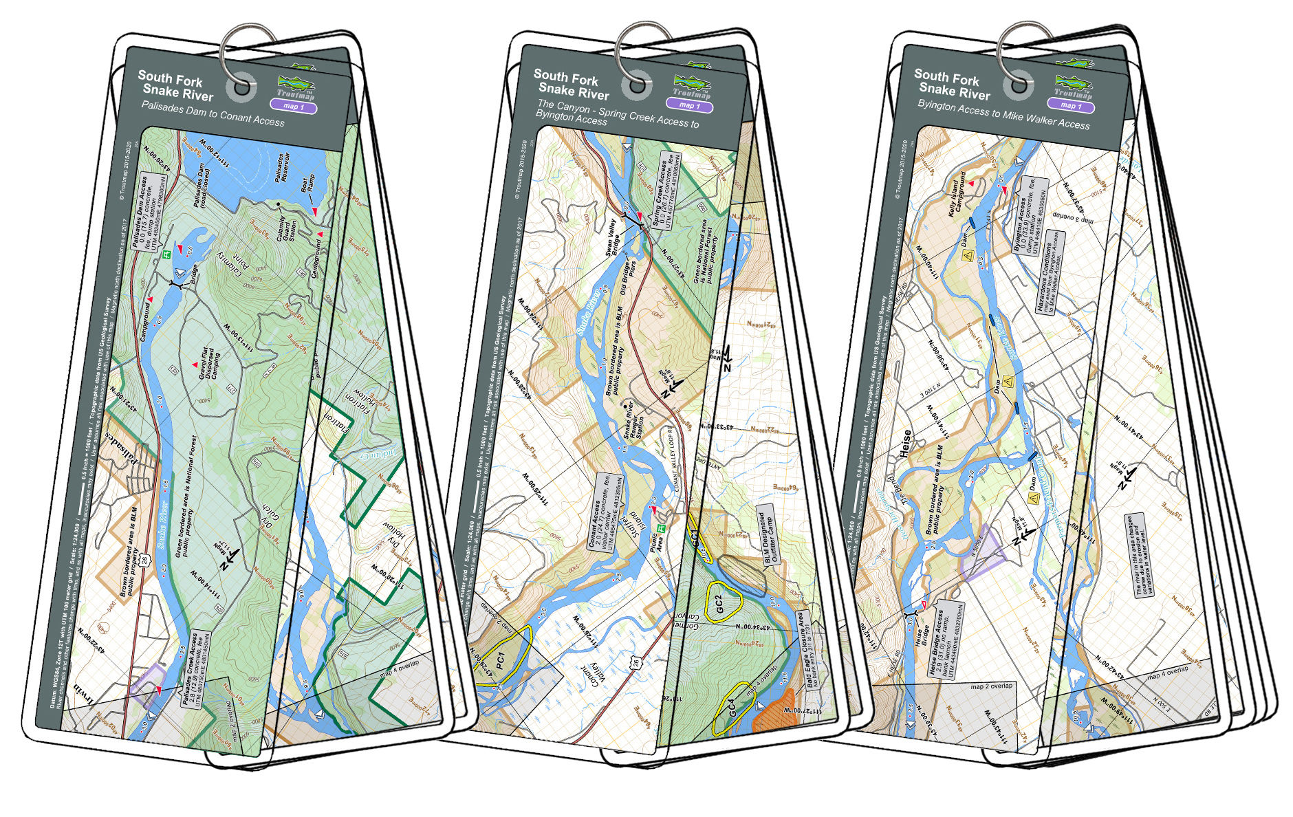

This river bundle covers Idaho's South Fork of the Snake River in three map sets: Set #1 covers the upper river for 15.7 miles from Palisades Dam to the popular Conant Access point. Set #2 covers the beautiful Canyon section for 26.7 miles, beginning at the Spring Creek Access (2 river miles upstream of Conant) and ending at the Byington Access. Map set #3 continues from the Byington Access for another 33.9 river miles, ending at the Mike Walker Access below Menan. This is a big river, well known for it's plentiful and large trout.
22 river maps and 3 area maps
South Fork of the Snake - River Bundle
Items are shipped with tracking information via USPS or UPS. Please make sure the shipping address you provide is acceptable for deliveries by the US Postal Service.
Shipping for most orders is Free! Click here for more details.
- Laminated and waterproof maps that follow the river channel.
- Individual maps are secured with a stainless steel split ring, and includes a snap hook that allows clipping to a cable retractor on waders or boat.
- Cable retractor is not included, but is available for purchase on our website - click here for more info.
- River features such as rapids, boat ramps, access points, campgrounds, and river camps are clearly shown.
- Each map set contains an area map showing the general location of fly shops, shuttles, lodging, fuel and places to eat.
- Approximate size: printed map: 3-3/8 inches by 10-1/4 inches; laminated page: 3-3/4 inches by 10-1/2 inches.